
Two sites in the South Hams belonging to South West Water (SWW) appear in a list of the UK’s worst methane spots.
The Guardian newspaper and Watershed Investigations carried out analysis of official methane emissions data taken from the National Atmospheric Emissions Inventory (NAEI).
The data appears in a Watershed pollution interactive map which identifies Britain’s worst methane hotspots, including livestock farm clusters, landfill sites and various types of industrial plants.
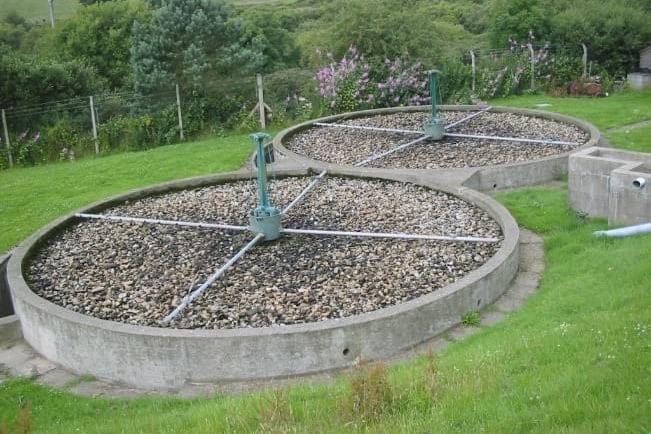
In the South Hams, the map reveals the sewage treatment works (STW) in Kingsbridge and in Totnes as ‘large point sources’ of methane from data taken in 2021.


Just outside the South Hams, in Paignton, the Alders Way power station, which belongs to UK Power Reserve, is also listed as a methane hotspot.
However, the three plants are not in the list of the 100 worst methane emitters in the UK. Among the biggest offenders is the site of the UK’s last coal mine in Wales - the Aberpergwm colliery – as well as Selby, home of the Drax biomass power station.
Greenpeace’s chief scientist and policy director, Dr Doug Parr, described the findings as “alarming” and told the Guardian that despite the UK joining a global pledge to reduce methane emissions by nearly a third by 2030, there was no proper British action plan to tackle the problem.
He said: “The new government must fulfil the UK’s international promises, and has the opportunity to come up with an exemplary, internationally leading plan for tackling methane from both the energy and farming sectors.”
The Guardian however highlighted concerns over whether the NAEI figures could be relied upon, with Drax power station claiming that the NAEI’s modelling produces emissions figures that are too high.
By contrast, some academics say the NAEI’s methodology downplays the amount of methane being released.
The Guardian reported that the NAEI uses a variety of “regulatory sources” and “surrogate statistics” to create its methane emissions data.
Aside from the methane hotspots the map also provides an array of data related to forever chemical sites, air and bathing water quality, revealing the different pressures that are placed on land, rivers, lakes, groundwater and seas.
To access the map, visit https://watershedinvestigations.com/